Northway Pointe - Charlotte Townhome Development Case Study
The Charlotte Townhome Development Project
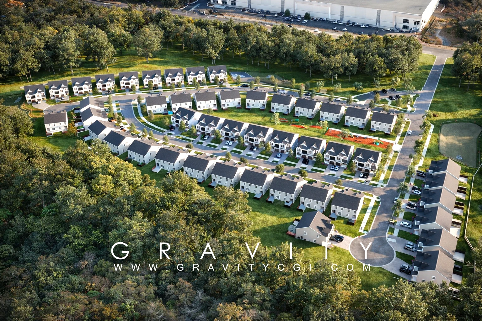
Northway Pointe is a 94-lot residential townhome development in Charlotte, North Carolina. The developer required professional aerial siteplan visualization to clearly present the site's layout and lot density to prospective buyers and investors as part of the land sale process, which completed in 2025.
Aerial Siteplan Rendering Solution
Gravity CGI delivered a focused aerial visualization package tailored to the land sale process:
- Aerial siteplan renders showing the full 94-lot layout, road network, and site boundaries
- Bird's-eye perspective renders communicating density, orientation, and neighbourhood context
- Renders produced to presentation quality — suitable for investor decks, broker packages, and due diligence materials
The Outcome
The aerial renders gave the developer a professional visual package to present the 94-lot site to prospective buyers, supporting the successful land sale to a major national homebuilder.
- 94-lot residential site successfully visualized pre-construction
- Site layout and lot configuration clearly communicated for the land sale process
- Renders used across broker packages, investor presentations, and due diligence materials
- Land acquired by a major national homebuilder following the sale process
FAQ: Northway Pointe Charlotte Case Study
How many lots were included in Northway Pointe?
The project included 94 residential townhome lots in Charlotte, North Carolina.
How were the aerial renders used in the land sale?
The visuals supported broker packages, investor decks, and due diligence materials to communicate site value and development potential.
What was the outcome of the sales process?
The land was acquired in 2025 by a major national homebuilder after the marketing and sale process.
Ready to Present Your Development?
Get a free quote within 24 hours — no obligation.
Request a Project Review